 Facebook
 Twitter
 LINE
LINE

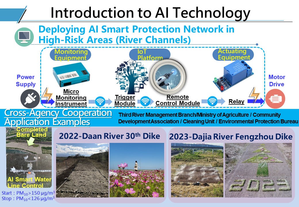
Overview:
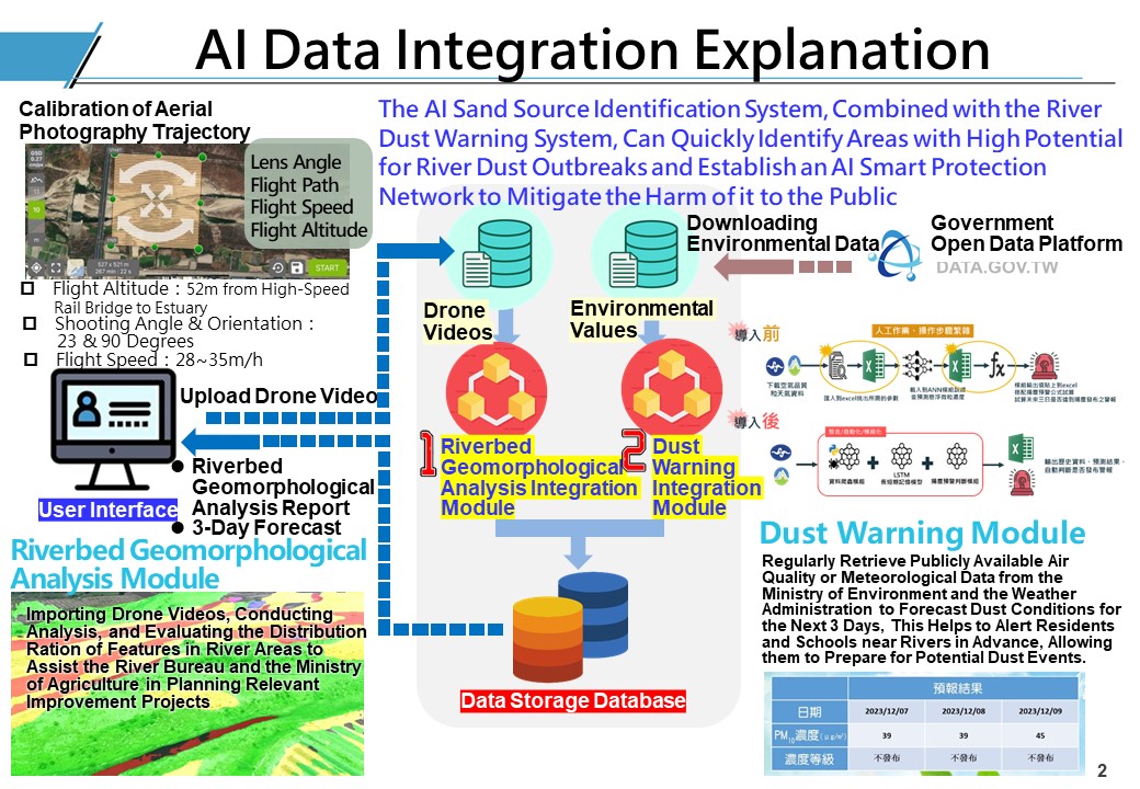
River dust from the region between the Daan River and Dajia River basins along Provincial Highway No. 1 in Taichung to the estuary has a wide impact on the surrounding area. Over the years, manual inspections, satellite imagery and other techniques have been employed to determine exposed locations. However, due to factors such as gravel, light source, and resolution, image analysis cannot be used to accurately identify gravel or sand sources. Even if drone aerial photography is used, it still takes time to manually select and calculate sand sources.
To quickly and effectively monitor potential river dust locations, the "AI Sand Source Identification System" was developed to establish a drone database for the automatic marking and positioning of sand sources and their respective areas. Moreover, in conjunction with the "River Dust AI Smart Protection Network", we can reduce the harm of river dust to the public and make response operations more intelligent.