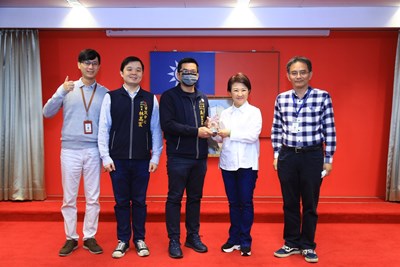
The Taichung City Government has received awards for its open geospatial data for 11 consecutive years, earning widespread acclaim! The Ministry of the Interior annually evaluates its Taiwan Geospatial One Stop (TGOS) platform affiliates. Taichung City has consistently been recognized for its geographic information's openness, applicability, stability, and service completeness. This year, the city not only won the “TGOS Distribution Service Award” for the 11th consecutive year with its “One-Stop Geographic Information Service, ” but the Environmental Protection Bureau also won the “TGOS Value-Added Application Award” for its “Taichung City Fixed Pollution Sources and Complaint Cases Smart Environment” system. Today (21st), the Research, Development, and Evaluation Commission Chairman Huang-Sheng Wu and Environmental Protection Bureau Director Hong-Yi Chen presented the awards at the city council meeting, demonstrating the city government's outstanding achievements in promoting open geospatial data and diverse applications.
Chairman Wu of the Research, Development, and Evaluation Commission stated that integrating municipal services with map applications has become increasingly mature. During last year's pandemic outbreak, the city government quickly launched the “Taichung Real-time Mask Map” within days in response to the central government's mask rationing policy, making it convenient for citizens to search and obtain mask information, significantly reducing waiting times for mask purchases. This year, they swiftly launched the “Taichung COVID-19 Case Movement Map, ” which presents clear and simple map visualizations, allowing citizens to know confirmed cases' movement history to enhance self-protection immediately. These timely applications have received high praise from citizens.
Regarding value-added map applications, the Environmental Protection Bureau explained that to monitor fixed pollution sources in Taichung City actively, they have combined cloud-based video monitoring equipment with artificial intelligence for real-time image analysis, enhancing pollution investigation effectiveness. The Environmental Protection Bureau also established a “Cloud-based Smart Environmental Monitoring System” that integrates crucial environmental information. When air pollution incidents occur, the monitoring system can be immediately accessed to understand the surrounding environmental conditions through map information, enabling quick response to air pollution cases and improving Taichung City's overall environmental quality.
吳主委進一步說明,因應疫情所帶來的數位服務應用不僅在民間企業,政府部門也積極朝此方向邁進,市府將持續提昇圖資品質,積極貫徹「陽光政治」的理念,多面向展現圖資服務及市民應用的便捷性,增進圖資整合應用的同時更加貼近市民需求。
Chairman Wu explained that in response to the digital service applications brought about by the pandemic, private enterprises and government departments are actively moving in this direction. The city government will continue to improve geospatial data quality and actively implement the concept of “sunshine politics. ” They will demonstrate the convenience of geospatial services and citizen applications from multiple aspects while making geospatial integration and applications more closely aligned with citizens' needs.

 Facebook
 Twitter
 LINE
LINE